The position of the chalet in relation to the Flegere lift, restaurants, bars, shops and so on is marked on here – click to see a bigger version.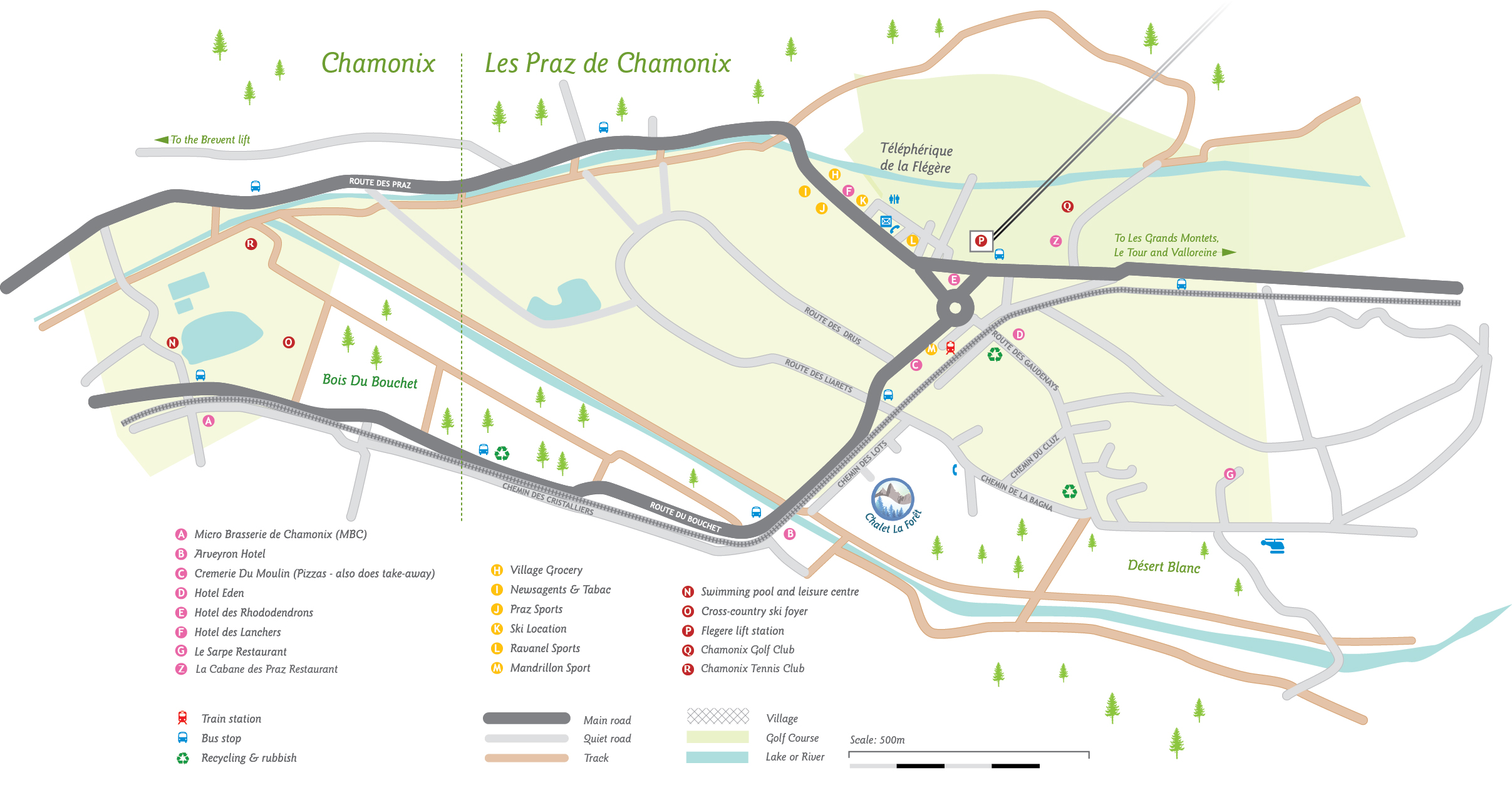
You can also see it on Google maps here.
Public Transport
Nearest bus stops
Vardesses: 200m away: walk back under the low bridge, it is right there. Line number 2 only
Flegere: 600m away, by the Flegere lift. Most lines stop here, in general it’s better.
Bus times www.chamonix-mobilite.com
Nearest train station: Les Praz-de-Chamonix, 600m away
Train times www.sbb.ch (available in English)
More information on here on trains, buses and taxis.
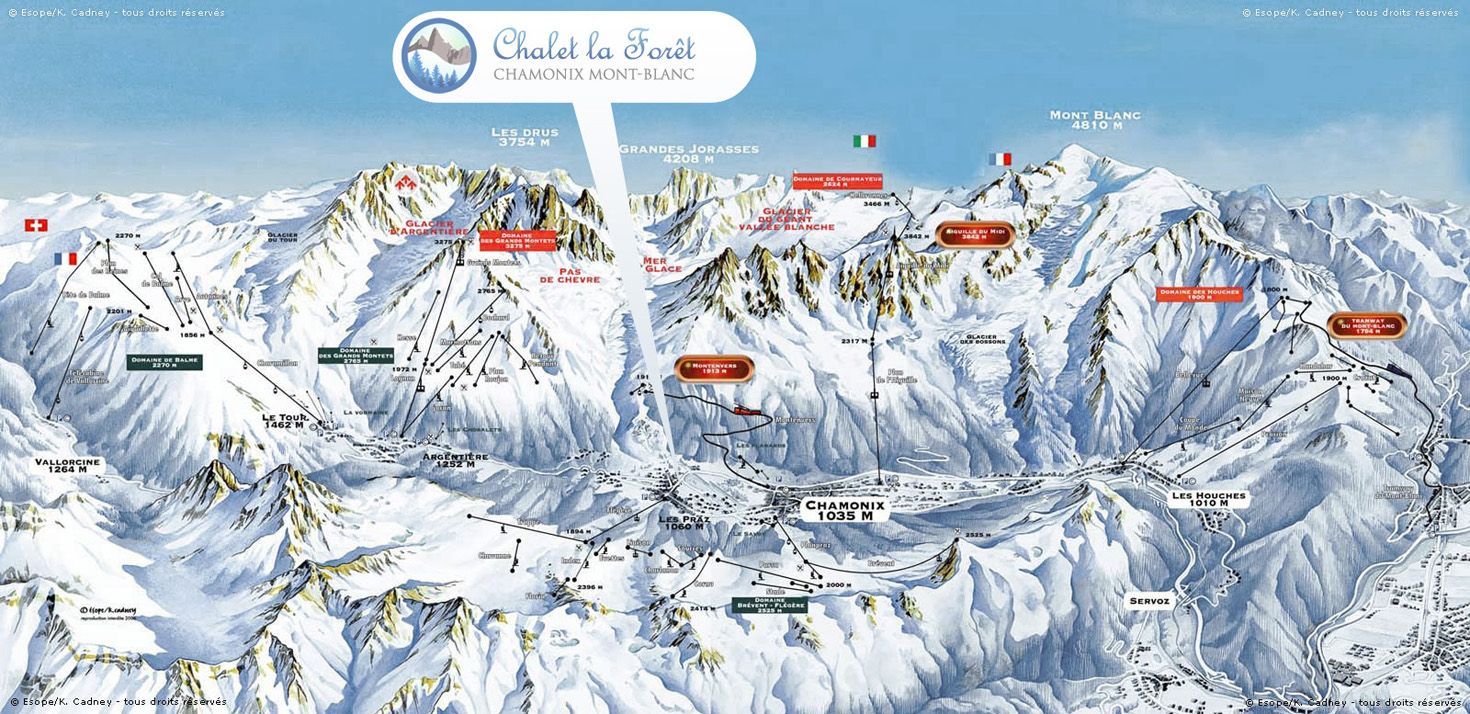
Winter: Our location within the ski areas
The new fast Flegere ski lift, accessing Brevent-Flegere (Chamonix’s largest and sunniest area) is a five to ten minute walk from the chalet, and the central position of the chalet is ideal for access to the other lift systems of Chamonix: Grands Montets, Le Tour and Les Houches.
Cross-country skiing map
Walk or ski from the chalet straight onto the cross country skiing trails about 100 metres away.
Summer Map: Lifts
We are at the heart of the network of trails on the valley floor and you can walk straight out of the chalet without needing to go on a road. In summer, some of Europe’s most spectacular mountain hikes can be started right from the door. Or the Flegere lift, within a 5-10 minute stroll, can whisk you up to the start of the high alpine walks.
Summer Map: Trail Running
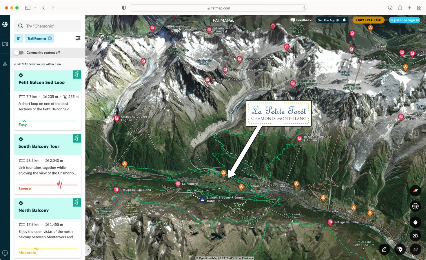
Many of these are also classic trail running routes, which again can be started from the door. Fatmap also has excellent info on trail runs: screenshot here with our position marked. Trail running routes are marked in green. The excellent Vallée du Trail site has downloadable maps and .gpx files is it’s up and running.
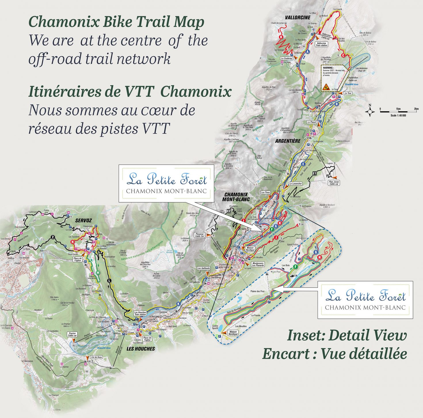
Summer Map: Cycling
Cycling at all levels, from relaxing flat valley floor trails to challenging all day routes, on roads or trails, directly from the door without needing to go on a road.